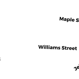
26-28 JEFFERSON ST
Owner Information
KLINE ROBERT S TRS
61 WASHINGTON ST
STONEHAM, MA 02180


Property Details
26-28 JEFFERSON ST is classified as a APT 4 - 8 UNT MDL-94 (Apartments).
The primary structure on this property was built in 1880. There are 8,278ft2 of built area within this property. There is 4,794ft2 of residential/living space within this property.
26-28 JEFFERSON ST is valued at $1,441,600. The land is valued at $636,500 and the structures are valued at $800,700. There is an additional valuation of $4,400 on this property.
This property is in Zone MR2. Confirm with local Zoning Board authorities to ensure there are no overlays or other easements on this property.
The most recent deed for 26-28 JEFFERSON ST is recorded at the local registrar in Book 12102, Page 85. 26-28 JEFFERSON ST was last sold on Wednesday, January 1, 1986 for $120,000.
Assessment data from fiscal year 2022.
Flood Data
According to the FEMA National Flood Hazard Layer, this property does not appear to be in a flood zone. It may also be in an area not yet reviewed. Nonetheless, confirm this information prior to taking any action.
To view the flood hazards around this property, create a FEMA "Firmette" Map of the area around 26-28 JEFFERSON ST.
Broadband Internet Providers
| Provider | Type | Bandwidth (mbps) | |
|---|---|---|---|
| RCN | Cable | 500 | 20 |
| GCI Communication Corp. | Satellite | 0 | 0 |
| HughesNet | Satellite | 25 | 3 |
| VSAT Systems, LLC. | Satellite | 2 | 1 |
| Viasat Inc | Satellite | 100 | 3 |
| Verizon New England Inc. | DSL | 5 | 0 |
| Verizon New England Inc. | Fiber | 940 | 880 |
| Comcast | Cable | 1000 | 35 |
| RCN | Cable | 1000 | 20 |
Broadband service provider data from December 2020.
Adjacent Properties
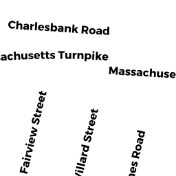
- 131 CHARLESBANK RD #A
Residential Condominium owned by KIN PUN HONG - 131 CHARLESBANK RD #B
Residential Condominium owned by HU ZHENYA & CHUHENG - 131 CHARLESBANK RD #C
Residential Condominium owned by MILLER MICHAEL P - 131 CHARLESBANK RD #D
Residential Condominium owned by GRODBERG NANCY SUE - 131 CHARLESBANK RD
Other, Open Space owned by 131 CHARLESBANK ROAD MASTER DEED - 34-36 JEFFERSON ST 34
Residential Condominium owned by HELMS JANET E - 34-36 JEFFERSON ST 36
Residential Condominium owned by LI TAO - 34-36 JEFFERSON ST
Other, Open Space owned by 34-36 JEFFERSON ST MASTER DEED - 22 JEFFERSON ST 22
Residential Condominium owned by BRABANDER DANIEL & JENNIFER - 20-22 JEFFERSON ST
Other, Open Space owned by 20-22 JEFFERSON ST MASTER DEED - 20 JEFFERSON ST 20
Residential Condominium owned by SMITH CAREN E - 123 CHARLESBANK RD 123
Residential Condominium owned by MURIELLO MARY ANNE - 125 CHARLESBANK RD 125
Residential Condominium owned by TARR AMY - 127 CHARLESBANK RD 127
Residential Condominium owned by FLANNERY TERESA - 129 CHARLESBANK RD 129
Residential Condominium owned by DAI WEI - 123-129 CHARLESBANK RD
Other, Open Space owned by 123-129 CHARLESBANK RD MASTER DEED